Oxfordshire Historic Landscape Characterisation project
This project, funded by Historic England, maps current and past land use across Oxfordshire.
What is Historic Landscape Characterisation (HLC)?
HLC uses maps to examine the historic and archaeological processes which have influenced the modern landscape.
It allows us to identify the specific characteristics of an area or district, so that we can understand what makes that place special or distinct and helping us to make sure it is managed appropriately.
It recognises that all parts of the landscape – from the Iron Age hillfort to the 1960s housing development – have historic value and contribute to the landscape in which we live.
How we can use it
HLC data can be used for:
- the conservation and management of heritage sites and landscapes
- planning applications and development strategy
- landscape management schemes
- academic and local research
- community projects and initiatives.
The local project
The project, which integrated earlier studies, examined Oxfordshire, and includes the three areas of outstanding natural beauty (AONB) - the Cotswold Hills, the Chiltern Hills, and the North Wessex Downs - as well as the district of Oxford.
The project produced:
- large-scale downloadable maps of Oxfordshire, showing the current landscape and what Oxfordshire looked like at the end of the 18th and 19th centuries, and the mid-16th century.
- an online interactive map
- a detailed database
- an online archive containing the project report, details of methodology used, descriptions and photographs of all the different historic landscape character types identified across Oxfordshire, case studies illustrating how HLC data can be used, and information regarding where data is held and can be accessed
- a series of public talks demonstrating the value of HLC data and how you can use it.
Timetable
The Oxfordshire HLC project ran from October 2012 to July 2017. Digitisation of the county was completed in December 2016 and any updates will be made on an ad hoc and piecemeal basis. Please contact us for more information about the project.
Online interactive map
Explore the online map to see how your village has changed since the 18th century, how the fields have evolved, and where remaining medieval parts of the landscape still survive.
Poetry project
Dr Romola Parish worked with the Oxfordshire HLC project as poet in residence. Using the HLC, Romola explored the hidden histories of Oxfordshire's landscapes and captured in her anthology of poems, The Polygon Poems. Download her poem on Stonesfield (pdf format, 73Kb).
About Dr Parish
Dr Romola Parish is a former academic specialising in landscape evolution, incorporating archaeological, geomorphological and anthropogenic approaches, and in environmental change, particularly in mountain environments. She now works in London as a planning and environmental lawyer.
She recently graduated with distinction from the University of Oxford MSt in Creative Writing. She has had poetry published in the Irish Literary Review, Snakeskin, Cardiff Review and The Lamp.
Landscape is an important focus of her creative work.
Historic landscape walks
Turn back the years and explore Oxfordshire’s past with these three walks inspired by the HLC project.
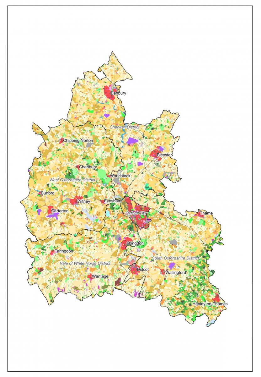
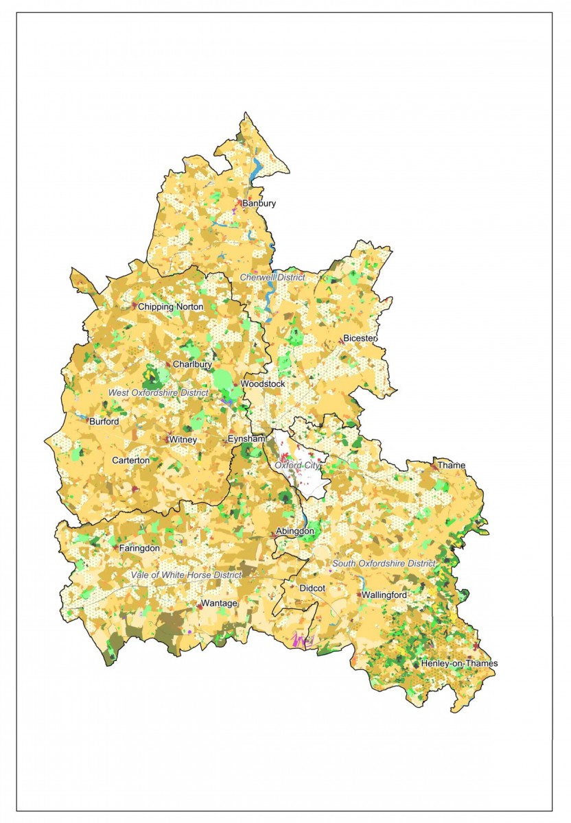
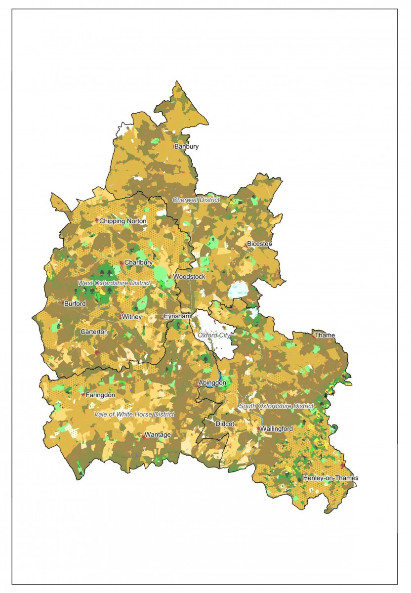
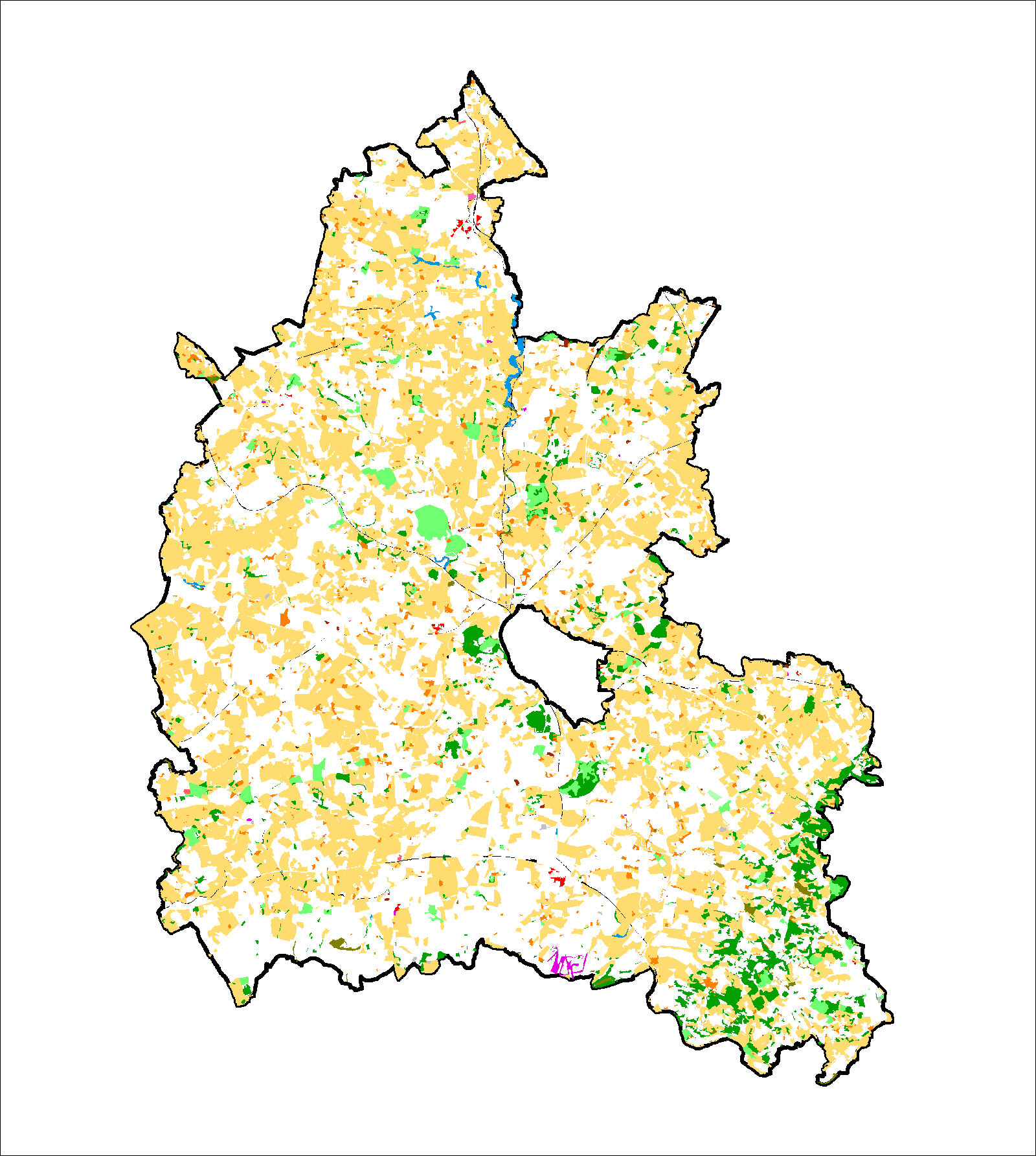
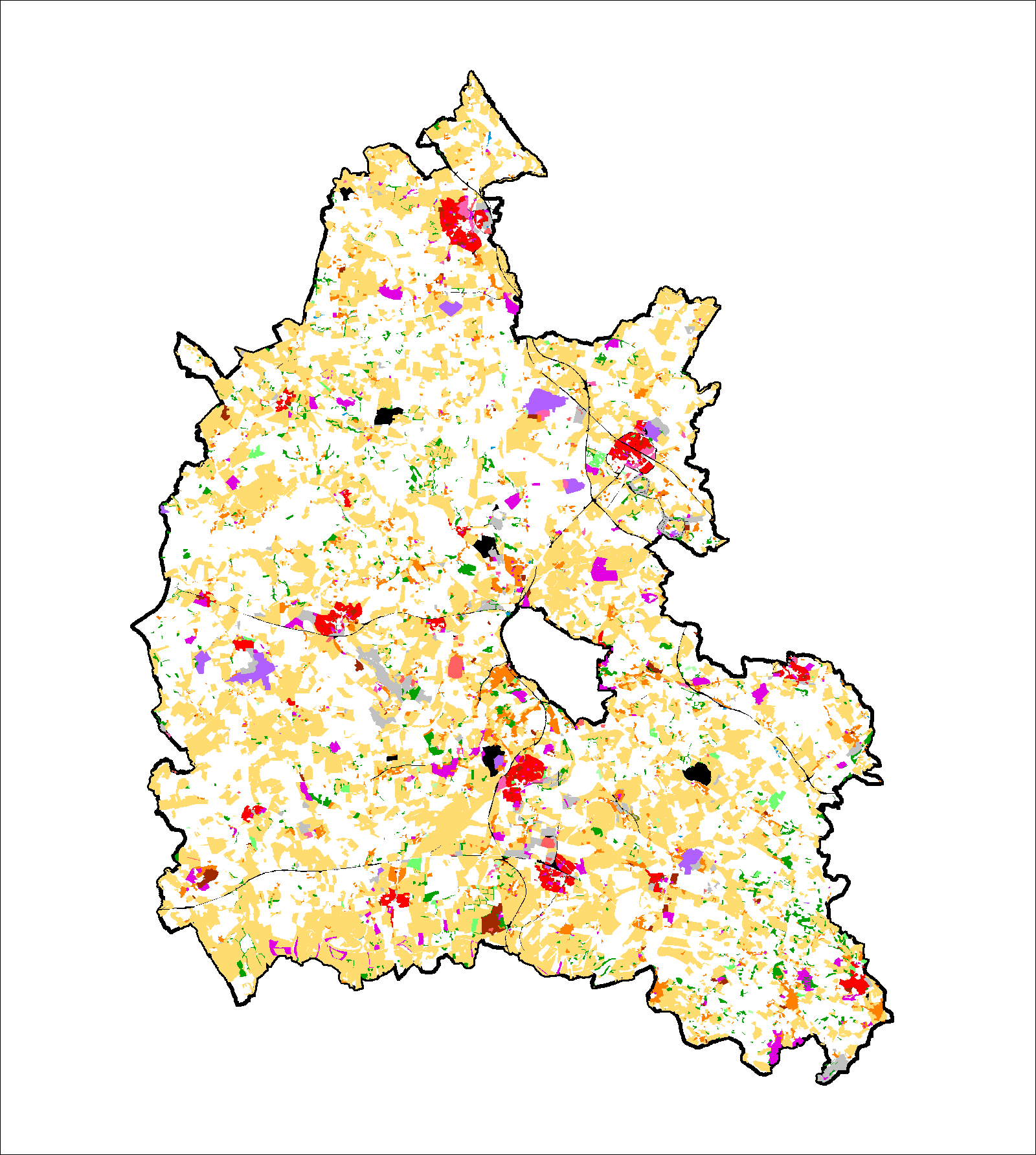
Historic landscape maps
Download maps of Oxfordshire's landscape in the 18th, 19th, and 21st centuries or see how old our current landscape is.
Oxfordshire's landscape in the 18th - 21st centuries
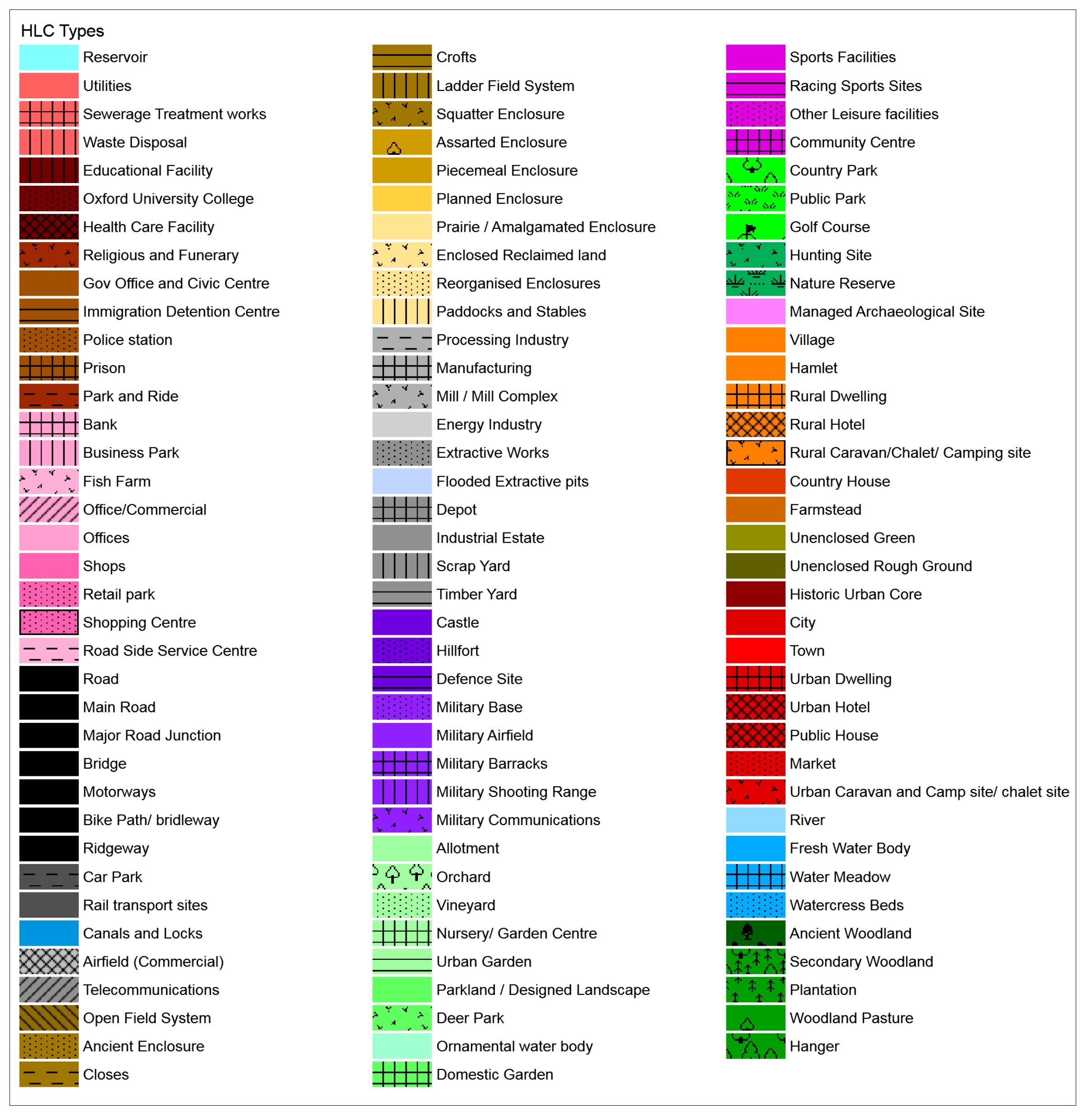
Key to HLC types (jpg format, 1.1Mb)
HLC types maps for the years:
- Early 21st century (pdf format, 215Kb)
- Late 20th century (pdf format, 215Kb)
- Late 19th century (pdf format, 197Kb)
- Late 18th century (pdf format, 182Kb)
Oxfordshire's current landscape
- Current map (jpg format, 2Mb)
- Surviving Medieval parts of Oxfordshire (jpg format, 476Kb)
- Surviving Post-Medieval parts of Oxfordshire (jpg format, 1.8Mb)
- Modern parts of Oxfordshire (jpg format, 2Mb)
Capacity modelling case studies: New woodland and urban development
Using the Oxfordshire HLC, two case studies were carried out to analyse the capacity of the historic landscape for the creation of new woodland and new large-scale urban development. Download the reports or have a look at the operational guides to see how you can use these studies to better manage change in our county.
The results of these analyses are also mapped on the online, interactive map.
New woodland
- Capacity for new woodland report (pdf format, 1.6Mb)
- New woodland operational guide (pdf format, 571Kb)
- New woodland data table (pdf format, 3.3Mb)
- New woodland map (pdf format, 1.4Mb)
- New woodland adjusted map (pdf format, 1.3Mb)
Urban development
- Capacity for urban development report (pdf format, 1.3Mb)
- Urban development operational guide (pdf format, 564Kb)
- Urban development data table (pdf format, 1Mb)
- Urban development map (pdf format, 1.4Mb)
Project archive
Explore the complete project archive online at the Archaeology Data Service. Here you can find the final and summary reports, project design, public presentations, maps, and the complete dataset to download as GIS shapefiles and linked database CSV files.
Final report
- Cover page (pdf format, 242Kb)
- Acknowledgements (pdf format, 136Kb)
- Executive summary (pdf format, 135Kb)
- Contents (pdf format, 312Kb)
- Chapter 1 (pdf format, 712Kb)
- Chapter 2 (pdf format, 2.3Mb)
- Chapter 3 (pdf format, 10Mb) this is a large file and may take time to download
- Chapter 4 (pdf format, 6.3Mb) this is a large file and may take time to download
- Chapter 5 (pdf format, 4.2Kb)
- Chapter 6 (pdf format, 416Kb)
- Chapter 7 (pdf format, 1.1Mb)
- Bibliography (pdf format, 246Kb)
- Appendices (pdf format, 1.4Mb)
Project documentation
- Report on individual historic landscape types (pdf format, 11Mb)
- Copyright and disclaimer (pdf format, 98Kb)
- Summary report (pdf format, 21Mb) this is a large file and may take time to download